Dong Van Karst Plateau Global Geopark Adventures
Dong Van Karst Plateau Global Geopark is a stunning landscape in northern Vietnam known for its dramatic limestone formations and cultural richness.
About Dong Van Karst Plateau Global Geopark
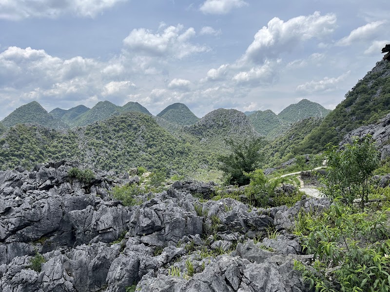
Dong Van Karst Plateau Global Geopark is a UNESCO-recognized geopark located in the Ha Giang Province of northern Vietnam. Covering over 2,300 square kilometers, it is famous for its rugged karst terrain, ancient mountain formations, and deep valleys. The area is a living geological museum, offering unique insights into the Earth's history, with rock formations dating back over 400 million years. This landscape is not only significant for its geology but also for its biodiversity, housing diverse flora and fauna, including several endemic species. The geopark is home to various ethnic minority groups, such as the Hmong, Dao, and Tay, each contributing to a rich cultural tapestry. Visitors explore the park through hiking, motorbiking, and cultural tours to interact with local communities and learn about their traditional practices. Notable landmarks include the Lung Cu Flag Tower and the Ma Pi Leng Pass, which offer breathtaking views of the surroundings.
Highlights
Ma Pi Leng Pass offers one of the most stunning views in Vietnam.
Lung Cu Flag Tower marks the northernmost point of Vietnam with panoramic views.
Dong Van Old Quarter is famed for its historical architecture and vibrant weekend markets.
Nho Que River provides opportunities for boating through dramatic gorges.
Notable Natural Features
Ma Pi Leng Pass
A sky-high mountain pass known for its breathtaking views over the Nho Que River and surrounding karst landscape.
Lung Cu Flag Tower
A symbolic monument at Vietnam's northernmost point, offering expansive views of China and the surrounding area.
Hmong Ethnic Village
Offers a glimpse into the lives and culture of the Hmong people, one of the ethnic groups residing in the geopark.